


Göta River
Göteborg (SE)
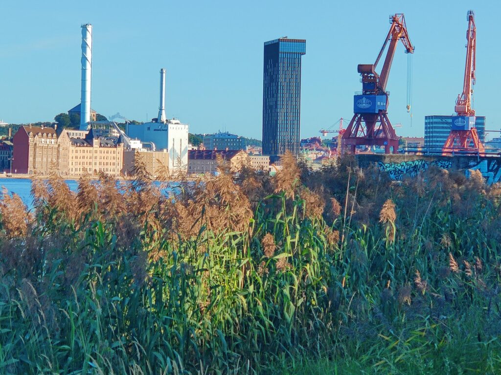
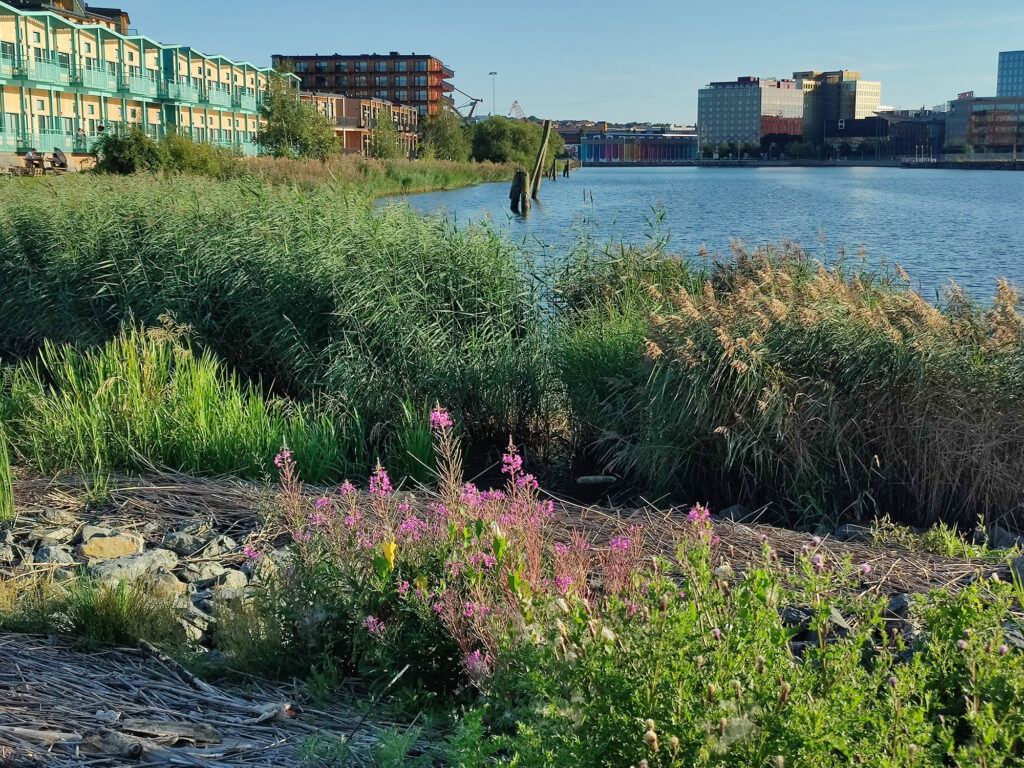
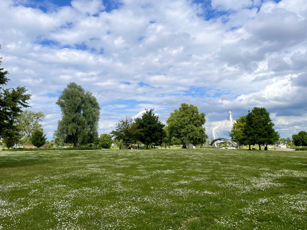
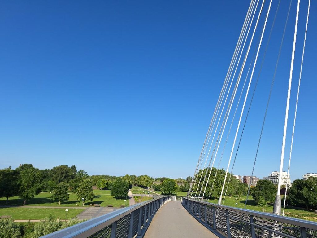
The study area for UGOT’s Riverscape Fieldwork is the Göta River (Göta Älv) in western Sweden, particularly around the city of Gothenburg. The river – one of Sweden’s largest – flows from Lake Vänern to the Kattegat Sea and has played a central role in shaping Gothenburg’s development. The Frihamnen district is situated along the Göta River in the heart of Gothenburg. Once a rich wetland estuary with extensive reed beds, it supported diverse birdlife and served as hunting grounds in the 19th century. During the 20th century, the area became industrialized with harbor infrastructure, railways, and factories. Today, Frihamnen is undergoing a major transformation into a mixed-use urban district, facing significant ecological and social challenges.
This riverside zone spans approx. 1 km² and is a key case in the PlaCES project. Public events held in conjunction with the city’s 400th anniversary between 2021–2023 engaged artists, planners, and scientists in re-storying the site through participatory art and multispecies storytelling. Its ongoing transition has inspired UGOT researchers to explore heritage as a cultural ecosystem service.
Critical features of the area include: loss of wetlands, historical bird habitats (e.g., for the ruff and black redstart), and the experimental urban park Jubileumsparken, developed with climate resilience and biodiversity in mind. Challenges include balancing dense urban development with ecological restoration. Frihamnen offers a living laboratory for integrating cultural and ecological values in riverscape planning.

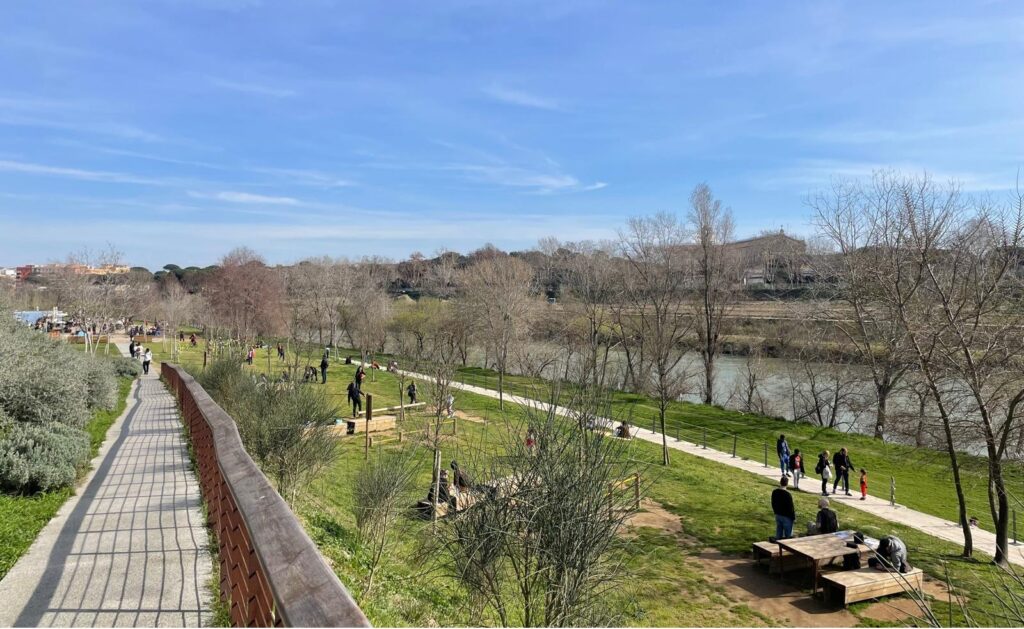
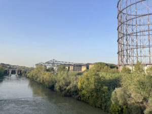
Tiber River in Ostiense/Marconi district
Rome (IT)
The Tiber River, originating from Mount Fumaiolo and flowing into the Tyrrhenian Sea near Ostia, is one of Italy’s longest rivers with a vast basin that has shaped the development of Rome and its surroundings. Beyond its historical role as a transportation route and industrial resource, the Tiber today is a key element in Rome’s ecological network and urban planning, offering important opportunities for creating green corridors and enhancing public access to natural spaces within the city. The study area for UNIROMA3’s Riverscape Fieldwork is the Ostiense-Marconi district, particularly the areas along the river Tiber, located in the southern sector of the city of Rome.
Once an industrial hub relying heavily on the river for transport and production, this district is now undergoing a major transformation aimed at reconnecting the urban fabric with the riverfront. These ongoing projects focus on improving accessibility to the Tiber by developing continuous green spaces and public parks along the riverbanks, transforming fragmented and underused areas into vibrant community assets. This transformation highlights the importance of cultural ecosystem services in the area, recognizing the river and its surroundings as both natural and cultural resources that contribute to the identity and livability of the neighborhood. However, there are many challenges, especially concerning the management of the river areas and their accessibility for local communities. Studying the cultural ecosystem services is therefore essential to strengthen the relationship between river and city, particularly in such a densely urbanized area.
Wellritz river and valley
Wiesbaden (DE)
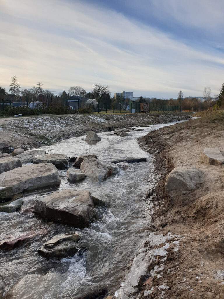
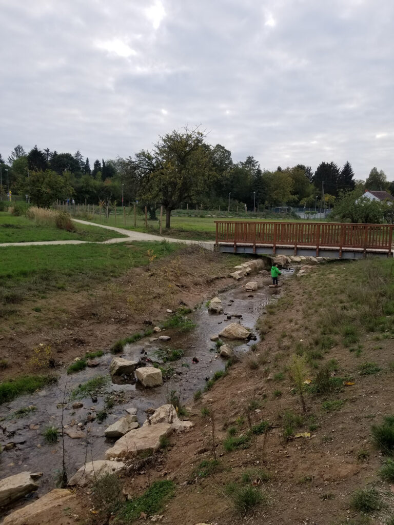
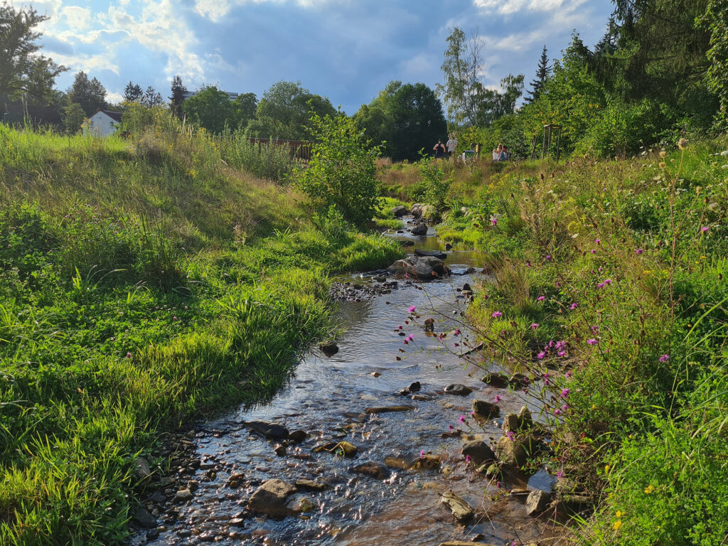
The city of Wiesbaden, Germany, has a historic connection to water. 250 km of rivers flow through the city area. Wiesbaden’s urban core lies in a basin and five rivers with numerous tributaries flow towards the center. A sixth river links the water system to the Rhine at the southern city border. Hot thermal springs attracted people at least since Roman times. In the 19th century, Wiesbaden became an aristocratic health resort. With the rapid expansion during this time, a sewage system was created that also brought the rivers underground. Due to water pollution, the piping of streams was considered a major hygienic achievement. Today, the salutogenic use of the thermal water is limited and the stream water is mostly clean, but 14 km still run underground and are invisible to Wiesbadeners and visitors alike. Thus, the city aims at restoring the river system and daylighting some of the underground sections.
The Wellritz river flows underground in the city center as well as above ground in one of Wiesbaden’s landscape parks. Historically, the Wellritz valley was characterized by small-scale agriculture, linen bleaching and milling. Since the 1950s, the river has been straightened, plant nurseries, allotments and hobby gardens have moved into the area, while the surroundings have been urbanized. In the 1980s, the renaturation of the stream began. Today, the area is a highly valued recreational area with the restored stream as its main attraction. The valley is also an important corridor for cool air and provides flood retention. Issues result from the high recreational pressure, while large parts of the landscape corridor are privately used and inaccessible, as well as from sewage overflows from an adjacent settlement. The underground parts of the Wellritz River flow through densely built-up areas and daylighting has not yet been implemented.
Jardin des deux rives
Strasbourg (FR)
The Jardin des Deux Rives is one of the most emblematic parks in Strasbourg. Located on both sides of the Rhine River (150 hectares), it connects France and Germany through a unique cross-border landscape design. The design embraced a symmetrical approach, reflecting the idea of equality between the two countries. Water plays a fundamental role in the layout and the symbolism of the park. The Rhine, once an impassable natural boundary, historically embodied the separation between France and Germany now unified a common Park. The park’s landscape architecture reflects this intention of unity: the water walls on the French side, located on either side of the central axis, mirror the dead arm of the Rhine on the German side. Temporary gardens with varied themes (European rights, etc.) are also designed symmetrically. They follow the curves of the water features, reinforcing a sense of continuity and harmony. The park is also dotted with many memorials and commemorative artworks, referring to key moments in Franco-German, European, and even international history, thus reinforcing the Park’ role as a symbol of reconciliation and dialogue. It attracts many visitors thanks to its wealth of recreational facilities: numerous walking paths, bike trails along the Rhine, picnic and barbecue areas, and multiple children’s play areas. These large green spaces encourage various outdoor activities as well as peaceful moments in nature. However, its ecological value can be questioned so as its role in climate mitigation.
